Badwater Road to Dry Bridger Road
The paved road from US-20 turns toward Bonneville at the junction below and switches from being Badwater Road to Bonneville Road. To stay on Badwater Road, you must turn left onto the gravel road. We returned to the spot we had left at the end of my last blog post.
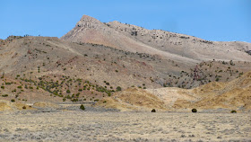
 There are a few side roads which lead off of Badwater Road but are not named. What follows are six shots from one of those dead-end roads.


 For the sake of perspective, I asked my wife to be a part of this photograph. It is a wall of columns, and this shot shows all of them.
 What follows is along the main road.
 Below is a close-up of above.

 Badwater Road continues southeast to Lysite at the junction above. The Lysite, Lost Cabin area has many of these natural gas drilling sites as seen below. Because of this, there are a few warning signs along the way.

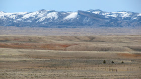
 What follows are shots taken from Point of Mountain Road.


 Pronghorns gallop away as soon as they see you, but this loner came trotting by us and passed within about 20 feet. It was so unusual that we weren't prepared to take any better shots than the one below.
 At this junction, we turned onto Bridger Creek Road.


 Then we turned onto Dry Bridger Road, or Hot Springs County Road Five which leads back to Thermopolis. The other roads we were on had been graded recently, but not so with this one.

 About a half mile past this cabin we encountered too much mud because of the melting snow, and so we turned around and decided to have our picnic lunch below. By the way, I didn't understand the nature of mud until I came to Wyoming.
  What follows are the shots I took on the way home, taking the same route.

 Below is the snow on the other side of the dam which holds back this small reservoir.
 This is a part of the dam:
 The next four photographs are a part of the ditch below, next to Badwater Road.


 The stones below are from the location pictured above. I found them all within a six foot radius.
 There are a few side roads which lead off of Badwater Road but are not named. What follows are six shots from one of those dead-end roads.


 For the sake of perspective, I asked my wife to be a part of this photograph. It is a wall of columns, and this shot shows all of them.

 Badwater Road continues southeast to Lysite at the junction above. The Lysite, Lost Cabin area has many of these natural gas drilling sites as seen below. Because of this, there are a few warning signs along the way.


 Pronghorns gallop away as soon as they see you, but this loner came trotting by us and passed within about 20 feet. It was so unusual that we weren't prepared to take any better shots than the one below.


 Then we turned onto Dry Bridger Road, or Hot Springs County Road Five which leads back to Thermopolis. The other roads we were on had been graded recently, but not so with this one.


No comments:
Post a Comment