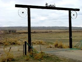
I like looking at how people mark their territory. Here are a few examples I found along the way.


 Since we hadn't fully explored Dutch Nick Road the last time we were here (see part 3), we thought this would be a good place to take a hike.

 Just beyond the scenic area is a small reservoir. Here is a satellite view of this area.


 I did use a zoom lens to photograph this rabbit, but I wasn't that far away. It didn't seem scared, and it did a good job of staying still long enough to let me get this shot.

 This is the sign at the junction of WY-431 and Dutch Nick Road.
 Here is a close-up of the sign above. Someone in Wyoming has a sense of humor.


 Since we hadn't fully explored Dutch Nick Road the last time we were here (see part 3), we thought this would be a good place to take a hike.
 Just beyond the scenic area is a small reservoir. Here is a satellite view of this area.

 I did use a zoom lens to photograph this rabbit, but I wasn't that far away. It didn't seem scared, and it did a good job of staying still long enough to let me get this shot.
 This is the sign at the junction of WY-431 and Dutch Nick Road.
 Here is a close-up of the sign above. Someone in Wyoming has a sense of humor.
link: index to photographs


Hello,
ReplyDeleteI'm Isa from France. Next year, I will travel from South Dakota to Wyoming for a few days (next I plan to visit Utah).
I have only one day to go to Cody from Buffalo. First, I thought it would be great to take road 14 and see Medicine Wheel... but watching at your pictures, I dont' know... Gooseberry Area seems to be very beautiful !
Did you walk a lot to see these wonderful rocks ? I won't have time to hike for hours. A 4WD is necessary ? On that day, I only want to take good time on a scenic road, seeing beautiful and unique landscapes.
Your photos are wonderful, thanks for sharing, and thanks in advance for your help.